


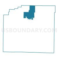
Sims Voting District, Montgomery County, Arkansas
About
Outline

Summary
| Unique Area Identifier | 527409 |
| Name | Sims Voting District |
| County | Montgomery County |
| State | Arkansas |
| Area (square miles) | 34.06 |
| Land Area (square miles) | 33.98 |
| Water Area (square miles) | 0.08 |
| % of Land Area | 99.77 |
| % of Water Area | 0.23 |
| Latitude of the Internal Point | 34.68092460 |
| Longtitude of the Internal Point | -93.65263370 |
Maps


Graphs
Select a template below for downloading or customizing gragh for Sims Voting District, Montgomery County, Arkansas


Neighbors
Neighoring Voting District (by Name) Neighboring Voting District on the Map
- Iron Creek Voting District, Yell County, AR
- Mt Ida Out Voting District, Montgomery County, AR
- Oden Out Voting District, Montgomery County, AR
- Pencil Bluff Voting District, Montgomery County, AR
- Washita Voting District, Montgomery County, AR
Top 10 Neighboring County Subdivision (by Population) Neighboring County Subdivision on the Map
- Mount Ida township, Montgomery County, AR (2,138)
- Oden township, Montgomery County, AR (944)
- Washita township, Montgomery County, AR (400)
- Pencil Bluff township, Montgomery County, AR (394)
- Sims township, Montgomery County, AR (361)
- Ions Creek township, Yell County, AR (88)
Top 10 Neighboring Unified School District (by Population) Neighboring Unified School District on the Map
- Two Rivers School District, AR (7,182)
- Ouachita River School District, AR (4,356)
- Mount Ida School District, AR (4,231)